WIMS ID: 300011
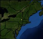
NAME: ALBANY PINE BUSH
LATITUDE: 42.719690
LONGITUDE: -73.864330
ELEVATION: 346 ft
MNET: RAWS
LAND COVER: 2001 USGS
DATA COURTESY OF:
Bureau of Land Management
and
N Y State Forest Div of Forest Protection
Change to Weather Map
Synoptic Data Map
Change to Graphical Display
Synoptic Graphical Displays
Change to Metric Units
Change to UTC Time
Change Date/Time
Download Data
MORE INFO
Station Information
Latency (delay of obs)
Nearby Stations (MesoWest)
Nearby Stations (Synoptic Data)
Restrictions