WIMS ID:
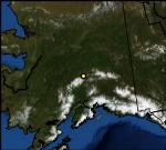
NAME: TOKLAT
LATITUDE: 63.525500
LONGITUDE: -150.046480
ELEVATION: 2920 ft
MNET: RAWS
LAND COVER: Avail for CONUS stns only
DATA COURTESY OF:
Bureau of Land Management
and
Denali National Park
Change to Weather Map
Synoptic Data Map
Change to Graphical Display
Synoptic Graphical Displays
Change to Metric Units
Change to UTC Time
Change Date/Time
Download Data
MORE INFO
Station Information
Latency (delay of obs)
Nearby Stations (MesoWest)
Nearby Stations (Synoptic Data)
Restrictions